Cargando...
Recursos educativos
-
Nivel educativo
-
Competencias
-
Tipología
-
Idioma
-
Tipo de medio
-
Tipo de actividad
-
Destinatarios
-
Tipo de audiencia
-
Creador
-
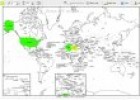
Printable world map
Tiching explorer Organización
- 7 lo usan
- 4943 visitas
Este recurso nos ofrece un completo generador de mapas mudos que nos permite diferentes variables ara personalizar: colorear países, introducir leyendas, trazar líneas, etc...El resultado final se…
-
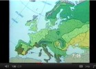
Geography Tutor - Map Skills
Tiching explorer Organización
- 1 lo usan
- 7519 visitas
Covers map directions, distances, scale, plotting latitude and longitude, common map symbols and features, and more.
-

Free Mind Map
Héctor Espinoza Hernández Docente
- 1 lo usan
- 3765 visitas
Edraw Mind Map is a vector-based mind mapping software. It allows us to create mind maps, brain-storming diagrams, project timeline, life planner, SWOT analysis and sketch maps. We need to download the…
-
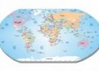
What is a map?
Maria Pallarés Docente
- 1 lo usan
- 4955 visitas
An introduction for young children to maps and the information they contain, including the colours and symbols on different types of maps. Duration: 4.32 minutes.
-
Free Mind Map
Tiching explorer Organización
- 2 lo usan
- 4425 visitas
Edraw Mind Map is a vector-based mind mapping software. It allows us to create mind maps, brain-storming diagrams, project timeline, life planner, SWOT analysis and sketch maps. We need to download the…
-
-
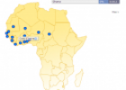
Map quiz: West Africa
Tiching explorer Organización
- 1 lo usan
- 4744 visitas
In this activity we have to click on the African countries to label them.
-
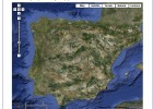
Satellite Map of Spain
Tiching explorer Organización
- 3 lo usan
- 4724 visitas
A satellite map of spain
-
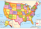
United States political map
Smart Organización
- 5287 visitas
SMART notebook resource. It includes states in 5 colors, with names, relief, and key rivers. We need to sign in to download the resource.
-
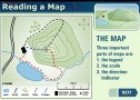
Reading a map
Maria Pallarés Docente
- 1 lo usan
- 3649 visitas
This multimedia activity provides students the opportunity to learn the basic features of the topographic map and the main parts of the map: the legend, the scale, the direction indicator, etc.
Te estamos redirigiendo a la ficha del libro...


